
NEW HOME BACKYARD GUIDE
Plan a new-build backyard
in Werribee
Start with the handover facts for your own lot. Test a direction from a site photo, then verify planning, levels, flood and drainage information, easements and access before comparing quotes.
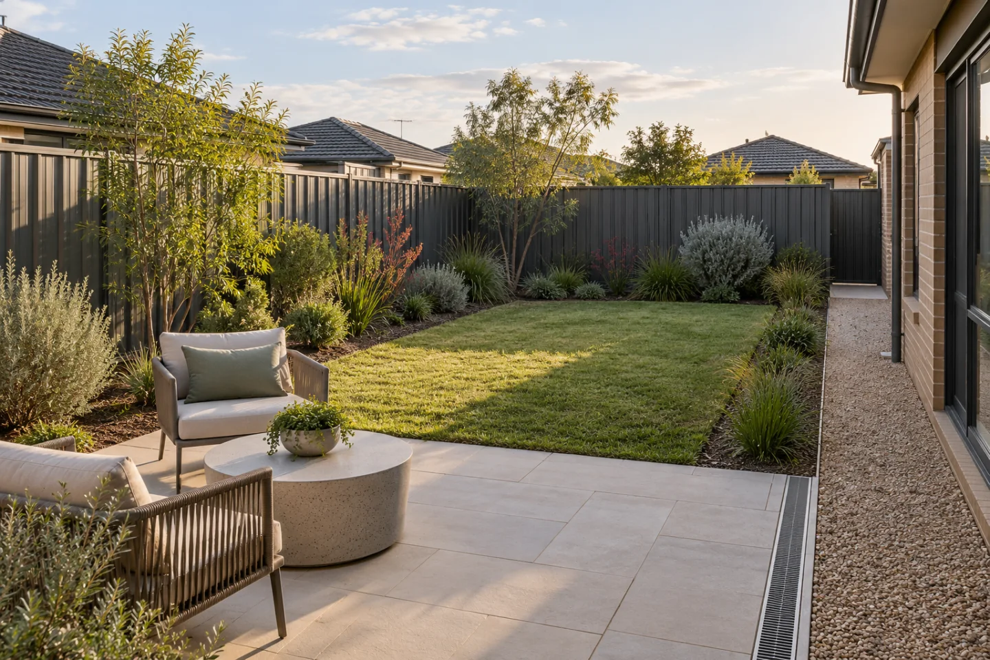
Personal homeowners receive 6 free AI generations with no expiry. A concept is not a measured plan, flood assessment, drainage design, asset location, structural design or construction approval.
LOCAL CONTEXT
Use Riverwalk for context, then check the exact Werribee lot.
Werribee includes established neighbourhoods and newer development settings. An estate or suburb name does not establish a property's current planning controls, flood information, title restrictions or asset layout.
The Victorian Planning Authority records Riverwalk as an approved Werribee precinct and provides its gazetted amendment and development-plan documents. That helps explain the wider growth-area setting, but it does not confirm which framework or site constraints apply to another Werribee address.
- Use the VPA property search to identify whether the address falls within a precinct structure plan.
- Generate the current VicPlan report for the property's zone and overlays.
- Read the issued title and plan of subdivision for easements, restrictions and authority interests.
- Keep builder handover, levels, drainage and service documents with the garden brief.
BEFORE THE FIRST SKETCH
Record six lot-specific facts.
Give the same measured information to each business. Do not estimate it from the concept image, an estate plan or a neighbouring block.
- 01
Title, planning controls and handover documents
Match the issued title and plan of subdivision to the current VicPlan report and any applicable precinct document. Record easements, restrictions, authority interests, builder drawings, warranties and handover conditions before fixing a garden layout.
- 02
Thresholds, finished levels and flood information
Record doors, weep holes, fence lines, low points and surface falls. If the property is affected by flooding, obtain the current property-specific advice and confirm the design criteria before adding fill, paving, retaining work or other changes to ground level.
- 03
Stormwater route and legal discharge point
Mark pits, downpipes and where water collects after rain. Wyndham defines the legal point of discharge as the approved point where private stormwater enters council drainage and requires the title for address-specific information, including after a new lot is titled.
- 04
Easements, water and sewer assets
Compare the title with current asset information. Greater Western Water lists landscaping, paving, decking, garden beds, retaining walls and earthworks among works that may need consent near easements or assets, with specific clearance rules applying.
- 05
Side access and council assets
Measure the narrowest gate, path, corner and overhead clearance. Photograph the crossover, footpath, kerb, drainage pits, street tree and nature strip before work, and ask how deliveries, spoil removal and machinery will protect those assets.
- 06
Sun, wind, water and upkeep
Track seasonal sun, western heat, exposed winds, hose reach, mower and bin routes, play needs and the household's realistic watering and pruning routine before choosing lawn area, screening plants or dense garden beds.
A PHOTO-BASED START
Try one practical visual brief.
Adapt this to the real photo. Keep measurements, flood and drainage advice, permits and construction decisions with the relevant professionals.
Using this Werribee new-home backyard photo, show a simple low-maintenance direction with a modest lawn, one compact pale-paver sitting area, a permeable path from the side gate and layered drought-tolerant planting. Keep the house, fences, doors, service areas and existing levels visually unchanged. Leave drainage, maintenance and delivery access clear. Do not add a pool, retaining wall or roofed structure.
COMPARE THE COMPLETE SCOPE
Use four work packages for like-for-like quotes.
Ask every business to quote against the same site facts and to state measured quantities, preparation, disposal, exclusions and approval responsibility. A material allowance is not the installed project price.
| Package | Resolve first | Ask the quote to show |
|---|---|---|
| 1. Site, water and protection | Planning and flood information, levels, thresholds, runoff, legal point of discharge, easements and service locations. | Survey assumptions, drainage responsibility, excavation, spoil, asset protection, temporary access protection and excluded reports or approvals. |
| 2. Access and hardscape | Delivery route, path and sitting-area footprint, falls, edging, boundaries and future maintenance access. | Base depth, compaction, product and quantity, cuts, drainage interfaces, structural work, permits, delivery and disposal. |
| 3. Soil, irrigation and lawn | Existing soil, imported depth, planting zones, watering method, lawn area and service clearances. | Measured quantities, soil preparation, irrigation components, turf or seed specification, establishment watering, testing and handover care. |
| 4. Planting and completion | Mature width, roots near assets, exposure, screening, mulch and replacement access. | Botanical names, pot sizes, quantities, spacing, mulch depth, stakes, establishment period, substitutions and replacement conditions. |
Keep property constraints explicit. Wyndham's legal-discharge information, Melbourne Water's flood advice and Greater Western Water's easement rules are address-specific checks; lawn, gravel or permeable paving does not remove the need to verify the actual drainage route, ground levels and authority constraints.
Compare landscaping quote scopeCHECK BEFORE CONSTRUCTION
A simple-looking backyard can still include regulated work.
Permit and consent needs depend on the exact structure, dimensions, natural ground level, boundary relationship, title, planning controls, flood information, easements and assets.
Wyndham says all garages, sheds and carports require a building permit, subject to limited shed exemptions; a structural deck requires one; and fence or retaining-wall rules depend on height, location, boundaries and easements. Greater Western Water separately requires consent for specified work near its easements and assets. These are screening questions, not approval for a particular design.
- Describe the structure, dimensions, footing, retained depth and boundary distance.
- Check planning controls, flood information, the title, easements and service authority requirements.
- Confirm who obtains permits, engineering, consents and inspections before signing.
- Keep the concept image as communication support, not evidence of compliance.
PROPERTY-SPECIFIC QUESTIONS
Before you commit.
What should I check before landscaping a new Werribee home?
Start with the issued title and plan of subdivision, builder handover and drainage information, finished levels, legal point of discharge, easements and service plans, measured side access and the current planning controls for the exact address. Riverwalk or another estate name is context, not an address-level approval.
Why should a Werribee garden brief include flood and drainage checks?
The relevant constraints depend on the individual lot. Use VicPlan to screen the address, obtain property-specific flood information when applicable, and confirm levels, low points and the legal point of discharge before changing falls, adding fill, paving or retaining work.
Can paving, garden beds or retaining work cover an easement?
Not by assumption. Greater Western Water lists landscaping, paving, decking, garden beds, retaining walls and earthworks among works that may need assessment near an easement or asset. Check the title and asset information, then obtain any required consent before construction.
Does RealScape confirm permits, drainage or buildability?
No. RealScape helps create an early visual direction and clearer landscaping brief. It does not survey the property, locate assets, model flooding, design drainage, verify approvals or replace a landscaper, plumber, surveyor, engineer, building surveyor, water authority or council assessment.
Primary sources and date checked.
Checked 31 October 2026. Sources describe public rules and guidance available on that date. Verify current requirements for the exact property and proposed work before construction.
- Victorian Planning Authority — Riverwalk Precinct Structure Plan
Riverwalk is an approved Werribee precinct; the page provides the gazetted amendment and development-plan documents but does not establish the controls for every Werribee address.
- Victorian Planning Authority — Greenfields Planning Interactive Status Map
Property search for identifying whether an address falls within a precinct structure plan.
- Planning Victoria — using VicPlan
Current property and parcel search for planning zones, overlays and downloadable reports.
- Wyndham City — legal point of discharge information
The approved point where private stormwater enters council drainage; a specific title is required, including for a newly titled lot.
- Melbourne Water — flooding information and advice
Property-specific flood information, development criteria and council referral context for flood-affected land.
- Greater Western Water — building over an easement and working near assets
Consent distances and assessment examples for landscaping, paving, decking, retaining walls, garden beds and earthworks near water or sewer assets.
- Wyndham City — when a building permit is required
Current local screening guidance for decks, pergolas, fences and retaining walls, including boundary and easement conditions.
- Wyndham City — street trees and open space
Nature strips remain council land; landscaping must retain service and street-tree access and follow council guidance.
START WITH YOUR OWN LOT
See the direction.
Then make the brief quote-ready.
Create a free visual concept, add the measured site facts and ask professionals to quote the same scope.